Using simulations from dense Landsat time series for crop yield estimations – a case study in Brandenburg, Germany
Milenka Hampel
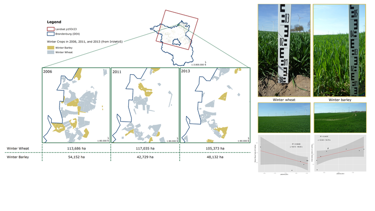
In the context of global change, the sustainable intensification of agricultural production to feed a growing world population is crucial, but assessing the intensity of e.g. crop production systems and its geographical extent is challenging. Crop yields are identified as an appropriate intensity output metric defining the output of crop production per area. To overcome the lack of spatially explicit yield information, yields can be estimated from remotely sensed Normalized Difference Vegetation Index (NDVI) time series that capture yield formation throughout the growing season as the fraction of the accumulated biomass. With the opening of the Landsat archive in 2008 the application rate of Landsat derived NDVI time series for fine-scale yield estimations increased. However, intra-annual variations in the availability of Landsat data exacerbate its application for yield estimation. Herein, a novel approach, the simulation of a dense and equidistant Landsat NDVI time series by a Support Vector Regression (SVR) approach, was tested and reveals reasonable gap-filling results for the study area of Northern Brandenburg for 2006, 2011, and 2013 by visual inspection. Performance constraints occur due to missing clear observations at the start and end of the season and the applied parametrization procedure. Yield estimation of winter wheat and winter barley by using the seasonally integrated NDVI and linear regression modelling shows no significant relationship with the highest coefficient of determination in 2013 for winter barley. Options for increasing the overall performance - e.g. the implementation of an automated, crop specific, and annual SVR parametrization approach, or its application in virtual constellations of complementing sensors such as Sentinel-2's MSI - are discussed.

