EcoSpy

Conservation planning and action critically relies on information about the dynamics in ecosystems, habitats, and species’ populations in order to define baselines, set conservation targets, and to identify areas for protection and restoration activities. Following the opening of the Landsat archives, remote sensing became a key technology for providing information to conservation, but many world regions experienced widespread changes in habitats and species populations prior to the Landsat history (1980s). In EcoSpy we propose to pioneer the broad-scale use of recently declassified historical, global, high-resolution spy satellite photographs from the Cold War era (Corona) to extend the temporal scale of ecological and conservation remote sensing studies as far back as the 1960s. We will integrate Corona with Landsat and Google Earth Images in three proof-of-concept studies to test the usability of Corona data for conservation research and applications. We will assess changes in (1) ecosystems of conservation concern, by identifying long-undisturbed forests and assess their fragmentation in Romania, (2) endangered species habitats, by analysing changes in saiga antelope habitat in Kazakhstan, and (3) keystone species’ population dynamics, by explain changes in a steppe marmots population density in Kazakhstan. Additionally, we will carry out a synthesis study on uses and benefits of Corona imagery for ecology and conservation worldwide. EcoSpy is deeply interdisciplinary, located at the intersection of ecology, conservation science and remote sensing. Scientifically, EcoSpy will enhance the long-term understanding of ecological processes such as fragmentation, range shifts and population dynamics, and it will extend availability of high resolution remotely sensed data by two decades prior to Landsat. EcoSpy will inform conservation action such as identifying priority conservation areas and defining conservation baselines for vulnerable habitats and species, advancing ecology and conservation worldwide.
EcoSpy 1: Ecosystems of conservation concern - old forests in Romania
In EcoSpy1, we use Corona data, Landsat time series, and historic maps to identify long-undisturbed forests and their connectivity in the Romanian Carpathians. Here, we test whether long undisturbed forests in the Romanian Carpathians are suitably connected to support old growth forest specialists. This work highlights the potential of Corona for mapping ecosystems of conservation concern and to contribute to the scientific understanding of how connectivity and fragmentation interact over long time periods.

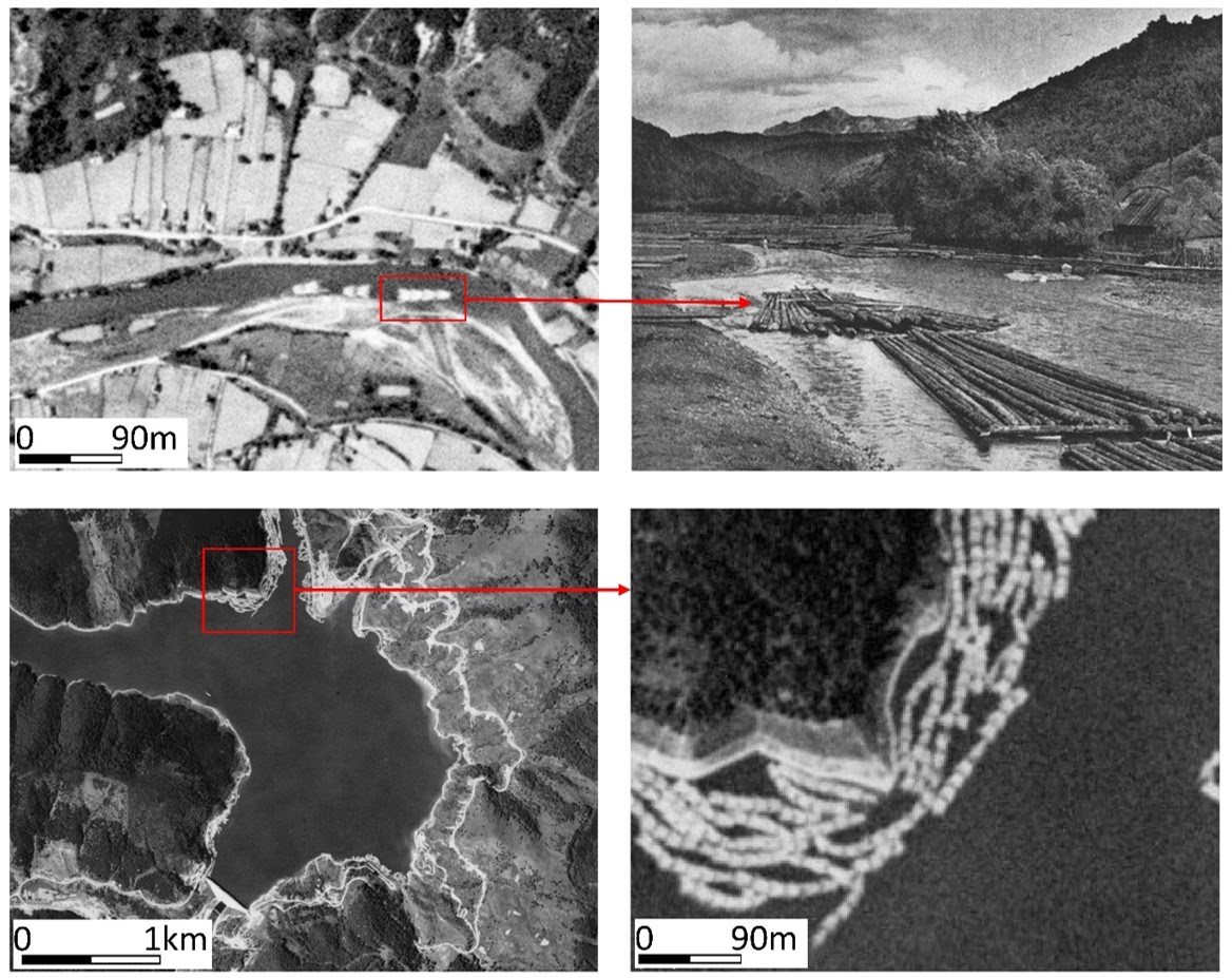
Image: Timber rafts transporting wood to the Black Sea, to be shipped to the former USSR. Romania was going to harvest 1mil. cubic meters per year for export in the 1960. Corona data allows us to capture these processes.
Related publication:
Nita, M. D., Munteanu, C., Gutman, G., Abrudan, I. V., & Radeloff, V. C. (2018). Widespread forest cutting in the aftermath of World War II captured by broad-scale historical Corona spy satellite photography. Remote Sensing of Environment, 204, 322-332. https://www.sciencedirect.com/science/article/abs/pii/S0034425717304844
EcoSpy 2: Endangered species’ distributions - saiga antelope in Kazakhstan
In EcoSpy2 we aim to understand the changes in saiga habitat since 1970s, using species distribution models based on Corona and Landsat derived landscape data. By the 1960’s, Saiga habitat might have already contracted drastically due to agricultural development, but the available suitable habitat likely increased again after 1990 due to land abandonment. Much of this habitat might be unoccupied, due to the recent poaching crisis and disease outbreaks, but identifying where suitable habitat is located is important for future conservation and restoration of this endangered species.
..stay tuned for updates…
EcoSpy 3: Keystone species’ populations - steppe marmots in Kazakhstan
Bobak marmots are a keystone species and ecosystem engineers of the Kazakh steppes; one of the most valuable steppe ecosystems worldwide for conservation. But in the 1960s the Kazakh steppes were largely converted to agricultural fields during the Virgin Lands Campaign; a political operation aimed to reduce food shortages in the former Soviet Union.
In EcoSpy3 we use Corona and Google Maps data to identify bobak marmot burrows and their response to wide-spread agricultural conversion. Here we show that the bobak marmots exhibit very high site fidelity and that, in the short-term, marmots prefer agricultural fields due to increased food availability. However, over long time periods, agricultural persistence leads to decreases in burrow density. This is important for planning steppe conservation and restoration measures.

Image: Bobak marmot burrows as seen in Corona images (left) and Google images (right). Over time, we find a decrease in the number of burrows, particularly in areas of continuous agricultural use.
Main contact: Dr. Catalina Munteanu
