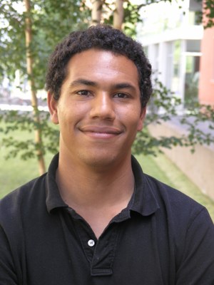
Dr. Akpona Okujeni
- Name
- Dr. Akpona Okujeni
| Status |
Postdoctoral researcher |
 |
| akpona.okujeni@geo.hu-berlin.de | ||
| Office location | Rudower Chaussee 16, Room 2'218b | |
| Phone | +49 (0)30 2093-6829 | |
| Fax | +49 (0)30 2093-6848 | |
| Postal address | Unter den Linden 6, 10099 Berlin, Germany |
About me
My research is driven by the immense potential Earth observation offers to explore and understand the ecosystems of our planet. I mainly utilize imaging spectroscopy data and multispectral time series to quantify land and vegetation cover, retrieve vegetation parameters, and monitor ecosystem change and vegetation dynamics through space and time. My studies extend across diverse terrestrial ecosystems and address environmental challenges related to global change, such as disturbance and recovery processes, or drought and wildfire impacts. Implementing innovative and effective image processing workflows for solving real-world application challenges forms the foundation of my studies.
Visit my website for more information.
Curriculum Vitae
|
Since 2022 |
Associated postdoctoral researcher, Einstein Research Unit Climate and Water under Change (CliWaC) |
|
Since 2014 |
Postdoctoral researcher. Earth Observation Lab, HU-Berlin, Germany (Projects: EnMAP Core Science Team, UrbanEARS). |
|
11-12 2012 |
Visiting researcher (DAAD fellowship), Columbia University, Lamont-Doherty Earth Observatory, New York. |
| 2009-2014 |
Doctoral researcher, Geomatics Lab, Humboldt-Universität zu Berlin (Project: Berlin II) |
| 2004-2009 |
Diplom-Student in Geography, Geoinformation Science and Geology, Humboldt-Universität zu Berlin. |
Publications
My full publication list can be found here.
